Berlin Wall (please english)
-
Berlin Wall (please english) · Ziltoidium (Gast) · 07.07.2016 08:19 · [flux]
Guten Morgen,
ausnahmsweise bitte in Englisch antworten. Ein Mapper aus Spanien fragt sich, wieso die alte Berliner Mauer anscheinend nicht in OSM erfasst ist (ich habe das nicht nachgeprüft!). Ich verweise mal auf diesen Thread hier.. DankeGood morning,
there is a question from a spanish mapper: it seems the old Berlin Wall is not mapped in OSM (i actually did not check this). Does anybody know about this??http://overpass-turbo.eu/map.html?Q=%2F … el%20qt%3B
edit: Frage kam über die Telegram Group: https://telegram.me/OpenStreetMapOrg
- Re: Berlin Wall (please english) · chris66 (Gast) · 07.07.2016 08:22 · [flux]
Äh, weil es sie nicht mehr gibt?? 😉
- Re: Berlin Wall (please english) · Ziltoidium (Gast) · 07.07.2016 08:24 · [flux]
What about historical tags? http://gk.historic.place/historische_ob … d=KmHaSaHe
- Re: Berlin Wall (please english) · chris66 (Gast) · 07.07.2016 08:41 · [flux]
Klar, an den Stellen wo sie aus Denkmalsgründen noch steht sollte historic=city_wall oder so gemappt sein.
Sure, at the locations where it is still existing for monument reasons it should be mapped as history= city_wall or so .
- Re: Berlin Wall (please english) · hurdygurdyman (Gast) · 07.07.2016 15:07 · [flux]
Soweit ich weiß, ist der alte Verlauf mindestens teilweise im Stadtbereich auf Straßen u.ä. markiert und somit on the ground zu erfassen.
As far as I know parts of it are marked on streets etc. inside the city and so we could map it on the ground. - Re: Berlin Wall (please english) · cziehr (Gast) · 08.07.2016 12:32 · [flux]
hurdygurdyman wrote:
Soweit ich weiß, ist der alte Verlauf mindestens teilweise im Stadtbereich auf Straßen u.ä. markiert und somit on the ground zu erfassen.
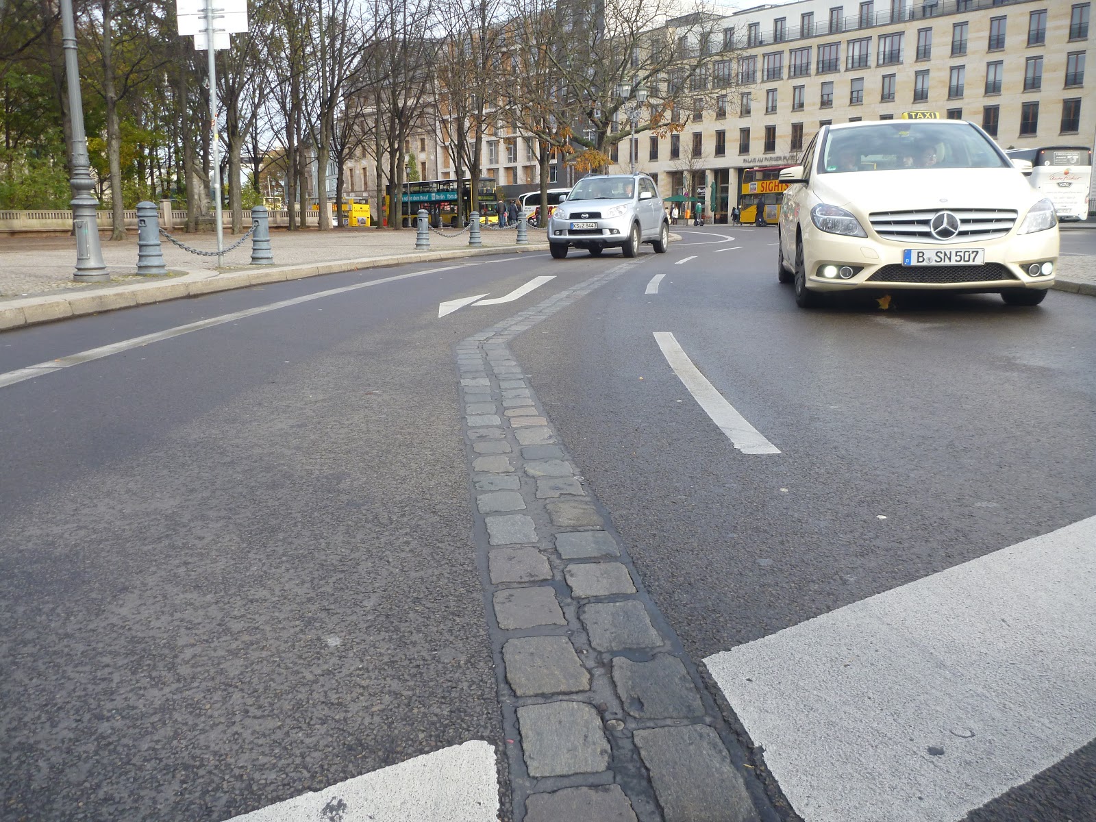
As far as I know parts of it are marked on streets etc. inside the city and so we could map it on the ground.Im öffentlichen Bereich ist der ehemalige Verlauf der Mauer durch eine Doppelreihe Pflastersteine gekennzeichnet, siehe verlinktes Bild.
In public areas, the former position of the Berlin Wall is marked by a double row of cobblestones, as shown in the following picture. - Re: Berlin Wall (please english) · projecter63 (Gast) · 15.07.2016 00:24 · [flux]
da tut sich etwas / something is happening : [http://overpass-turbo.eu/s/hjI]
-
- Re: Berlin Wall (please english) · Hakuch (Gast) · 16.07.2016 10:16 · [flux]
where do they get the border data from?
- Re: Berlin Wall (please english) · lutz (Gast) · 16.07.2016 10:44 · [flux]
interessant, eine Zeitleiste, schöne Seite...
Grüße von Lutz
- Re: Berlin Wall (please english) · mj10777 (Gast) · 25.07.2016 14:09 · [flux]
Hakuch wrote:
where do they get the border data from?
Probably self made.
they are, in any case, not the same as can be found here:Verlauf der Berliner Mauer, 1989
http://fbinter.stadt-berlin.de/fb/wms/senstadt/k_mauer
(if you use QGIS, just add the above line to the 'Add WMS ..' dialog)The shapefile were created based on the shown aerial map taken on 25.April 1989.
These shape-files shapefiles, which belong to the open-data project, can be requested by email:Markus.Breithaupt@senstadtum.berlin.de
Note: at present the zip file does not contain the needed .prj file, but that can be downloded at:
http://spatialreference.org/ref/epsg/et … e-33n/prj/
Also for use with Spatialite and QGIS, you must rename all of the file-extensions to lower case where needed.
Mark Johnson, Berlin Germany